Tag: cycling

Killearn to Loch Arklet cycle

Another day, another cycle blog. Think this will be the last cycle I get to do in Scotland, before going back to home to England on Monday. I am well pleased with myself, I got in four cycles this trip. Done the most miles I have done in Scotland, since August 2009. Been on lots of roads, I have never cycled on before in my life.

So now on with today’s cycle. For the first section of the cycle, I followed much of the same route as the Duke’s Pass cycle, that I did on Sunday 11th October. But instead of following the National Cycle Network (route 7), I turned onto the B829 (Lochard Road).

Then I followed that road, all the way up to Loch Arklet. When I set off I was hoping to make it all the way to Inversnaid, but I had to turn around at Loch Arklet, if I had kept on going. There was no way, I would have made it home before it got dark.

I don’t think I could have picked, a better place to turn around. Check out the view yourself using Google Steetview to see what I mean! Here is the URL for the the view  to save yourself for having to find it: g.co/maps/fnt4h.

And before I leave you will the normal stuff. Here are some interesting statistics for you. In just four cycles, my elevation gain stands at 2,196 metres or 1.36 miles. It’s also like cycling one and a half times the height of Ben Nevis.

Photos from the cycle:-

Sorry I only got three photos during the cycle. It was pissing it down most of the time. I did not want to get the camera any wetter than I had to.

Loch ArkletB829 near Loch ArkletB829 near Loch Arklet

Route map:-

Elevation graph:-

Route statistics:-

  • Distance: 44.79 miles
  • Time: 3:37:15 (h:m:s)
  • Avg Speed: 12.4 mph
  • Max Speed: 26 mph
  • Elevation Gain: 563 meters

Data from: Garmin Connect.

Killearn to Duck Bay (Loch Lomond) cycle

I can’t believe how many cycles I have got to do in Scotland this holiday. Think I can safely say, it’s the most number of miles I have done in Scotland on the bike, since doing the End to End cycle, way back in August 2009. Including today’s cycle I have done 65.76 miles. Also in just three cycles my elevation gain stands at 1,633 metres.

So now on with the route I took today. The title may give the route away, I cycled from Killearn to Duck Bay, which is on the western side of  Loch Lomond. It was great route, many roads I have not been on since I was around 19. Also covered a good number of roads and cycle paths I have never seen on before.

This time, I am not going to say that much about the route, since the map will do a far better job it! I will just tell you about the highlights.

Believe it or not. I should have done this route when doing the End to End cycle. But I only made it, to the Loch Lomond Youth Hostel (now closed), which happens to be the other side of  the A82 from Duck Bay. Then my Dad give me a lift the rest of the way to Killearn. So that is main reason I wanted to do this cycle, to fill in the missing link.

Also now I have done this cycle. Next summer my aim is to cycle even more up the side of the Loch and get lots of photos. Since when doing this section of the End to End cycle, I did not get a single photo. So it will be nice to make up, for it at some point.

Here is the view from the point I turned around and cycled back home.

[streetview width=”100%” height=”250px” lat=”56.016741″ lng=”-4.611766999999986″ heading=”10.30645161290326″ pitch=”-3.7741935483870943″ zoom=”1″][/streetview]

So now I have told you a bit about the route and why I wanted to do it. I will leave you will the normal photos, route map etc.

Photos from the cycle:-

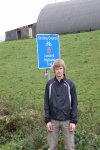
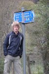
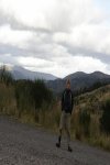
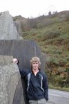
Sign post on the NCR 7Duck Bay, Loch LomondBridge carrying NCR 7 over the River Endrick

Route map:-

Elevation graph:-

Route statistics:-

  • Distance: 29.37 miles
  • Time: 2:26:08 (h:m:s)
  • Avg Speed: 12.1 mph
  • Max Speed: 24.7 mph
  • Elevation Gain: 445 meters

Data from: Garmin Connect.

Duke’s Pass cycle

I am well happy, since when I first come to Scotland last week the weather was a not very good at all. But lucky since then we have had two OK days, weather wise. When I mean OK, it did not rain. So I really wanted to make the most of it. So I made it out on the bike again. This time I cycled from Killearn to Aberfoyle then up and over the Duke’s Pass.

Just to give you an idea of what it’s like here is a video of someone else doing it, but using a motorbike.

While you watch the video. I will tell you a bit more about the route. I set off from Killearn at 12:44pm, following the A875 towards Balfron, turning left just before Boquhan, where the road goes down hill very fast then over the River Endrick. Where I stopped to take the first photos (Old road bridge near Boquhan and New road bridge near Boquhan) during the cycle.  Then I stayed on that road till it meets up with the A81 at Balfron Station. Then I tuned left, towards the Ballat Crossroads where I stopped to take more photos.

I stayed on that road, till Cobleland, yes that’s really a place name. Not really much there, just a Caravan & Camping site, some houses and the bit I cared about. The access to the National Cycle Network, route number 7. It was time to stop, yes again and take some more photos. I stayed one this very, nice flat section to Aberfoyle.

This is where the fun really started. Since I had the fun of cycling from around sea level (Well if the Garmin connect website is to be believed. I need to look out a local OS map and double check that one). To 238 metres, which does sound about right. This section of the route was not only hard doing since it meant a lot of cycling, it was also off all road using Forestry Commission tracks, which also doubles up has the National Cycle Network, route number 7.

I following this route till it joined the A821 at the exit of 3 Lochs Forest Drive. Then I turned left and had the great fun of cycling over the Duke’s Pass. You get some great views from that road. And also the 10% down hill section all the way into Aberfoyle to look forward to.

Then I just about followed the same route I took to Aberfoyle, all the way back to Killearn.

Now I will leave you some photos, route map and statistics from the cycle.

Photos from the Duke’s Pass cycle:-

Old road bridge near BoquhanSign post on the NCR 7Waterfall3 Lochs Forest DriveDuke's Pass

Route map:-

Elevation graph:-

Route statistics:-

  • Distance: 36.39 miles
  • Time: 3:03:48 (h:m:s)
  • Avg Speed: 11.9 mph
  • Max Speed: 26.9 mph
  • Elevation Gain: 697 meters
  • Max Elevation: 238 meters

Data from: Garmin Connect.
Happy days, I got out a cycle

Happy days, I got out a cycle for the first time, since getting to Scotland last Sunday. Till today, the weather has been to rain and windy most days. Also since the bike I use here is off the road right now. I had to wait for a new GPS holder to turn up, so I could fit my Garmin Edge 705 to my Dad’s bike.

It felt weird using my Dad’s bike. Since it does not have clip-less pedals or toe-clips. Like I am use to. I was hoping I could fit the toe-clips off my bike, onto my Dad’s bike, but they did not fit his bikes pedals. It was weird, it was like learning to ride a bike all over again. I could not work out where to put my feet at all.

So now on with the main event. The cycle it’s self. It was a great cycle. Went on roads I have not been on, since 2000. If not before and also covered roads, I have never cycled on before in my life. Plus lucky the rain stayed off. It was a bit on the cold side at times, then I did climb to 336 metres at one point.

I must say, I did really feel the hills today. In Scotland I can do 50 miles and not even feel it when I got home. I only did 26.34 miles. And my legs really did notice it. Then lots of that could be, riding a bike I am not use to at all.

So now here are some photos from the cycle, then will follow the map. And the cycling statistics, that I know make your day when I post them :).

Taken on the Crow Road (B822)

Taken on the Crow Road (B822)

Taken on the Crow Road (B822)

Route map:-

Not the best map in the world. Makes the route look really boring when it’s anything but. If you have the time, I would look at the route using Google Street View.

Elevation graph:-

Route statistics:-

  • Distance: 26.34 miles
  • Time: 2:19:51 (h:m:s)
  • Avg Speed: 11.3 mph
  • Max Speed: 21.1 mph
  • Elevation Gain: 491 meters

Data from: Garmin Connect.

September’s 2011 most popular photos

Below are the top three most looked at photos on this website during September.

Number 1 (416 views)
Adidas full body suit

Number 2 (248 views)
Adidas full body suit

Number 3 (215 views)
UCI World Cup Team skinsuit

September 2011 cycling statistics

Here are my cycling statistics for September.  My yearly total now stands at 4,434.5 miles. Total miles since April 2003 is now at 20,994.3.

So if nothing goes wrong, looks like I will make the 5,000 mile make before the year is out :).

Here is the data from September 2011:-

  • Total cycles: 27
  • Total Distance: 544.04 miles
  • Total Time: 40:11:57 (h:m:s)
  • Avg Speed: 13.5 mph
  • Max Time: 7:20:29 (h:m:s)
  • Max Speed: 30.3 mph
  • Avg Distance: 20.15 miles
  • Max Distance: 100.44 miles

Data from: Garmin Connect.
Here are my favourite cycling photos from the month:-

My new cycling shoes are here

First all of happy birthday to my older bother Douglas and my Dad. Hope you are both having great days, sorry I could not make it up to Scotland for them.

So now on with other news. My new cycling shoes, that I ordered from Fat Birds Don’t Fly, last Thursday I think it was. Have turned up :). Can’t really say to much about them to far, since I have still to take them out for a test ride. They fit, which of course is always a good start. In the photo to the left you can see the new ones at the back and old ones at the front.

Hoping that the wind drops off a bit later, so I can see what they are like on the bike.

That’s all for now folks :).

Shimano M077 Mountain Bike SPD shoes

I have just gone and ordered myself some new cycling shoes. Since my summer ones have had better days. But they have done me very, very well indeed had them since 17th December 2005 (click link to read about them). Used them while doing the End to End cycle, they have been around Rutland Water many times and I even used them while doing my record 100 mile cycle last week.

I just hope the new ones that I am getting last me, half as long. I am getting “Shimano M077 Mountain Bike SPD shoes” which I am sure you worked out from the title of this post :). I have ordered them from Fat Birds Don’t Fly. I love that name, what a great name for a bike shop. They have set me back £49.99, but full RRP is £69.99 so a saving of 30%.

I will let you know how I get on with them, when they turn up. Which I am hoping will be this week at some point.

First ever 100 mile bike ride

I am so pleased with myself, I did my first ever 100 mile bike ride today. It’s been one of my cycling goal’s since doing the End to End cycle back in August 2009. The only bad thing about it, was finding roads to get to 100 miles. If you have a close look at the map, you can see where I had to go, a mini cycle around Castle Bytham and my home village of Little Bytham to get the miles up.

So next time I plan a 100+ mile bike ride, I will need to sort out the route before I set off and may even go for 120 miles the next time :). But I ca’t see it happening this year, since it gets dark around 7:30pm now. So it will give me something to look forward to next year!

So now on with some of the statistics from the cycle.

  • Distance: 100.44 miles.
  • Time: 7:20:29 (h:m:s).
  • Avg Speed: 13.7 mph.
  • Max Speed: 26.5 mph.
  • Elevation Gain: 709 meters.

Data from: Garmin Connectconnect.garmin.com/modern/activity/114613864.

Below is the route I took while doing the 100.44 mile cycle.

In case you can’t really picture 100 miles in your head. It’s like cycle from Stamford to Cambridge and back again and still having around 10 miles to play with. Or cycling from Stamford to Sheffield and still having 12 miles to play with.

Oh and sorry I took no photos at all during the cycle. No idea why, on the longer cycles, I next to never stop to take any :(.

Beating last years record miles on the bike

I am well pleased with myself I have just gone and beating last years record number of miles on the bike. Last year I did 4,001.3  miles. So far this year I have done 4,046.7, to think it’s only September. So I have another 3 and half months left to get even more miles in. So I may even get up to the 5,000 mile mark, before the year is out!

Here are the main cycling statistics for the year so far…

  • Total cycles: 174
  • Total Distance: 4,046.7 miles
  • Total Time: 309:47:59 (h:m:s)
  • Avg Speed: 13 mph
  • Max Time: 5:24:01 (h:m:s)
  • Max Speed: 33.9 mph
  • Avg Distance: 23.21 miles
  • Max Distance: 71.94 miles

Data from: Garmin Connect.