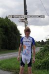
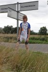
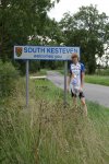
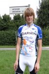
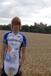
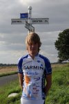
Got to love some of the village and town names in the UK. Yes Bitchfield is really a name of a village, in Lincolnshire just down the road from me!
Irn-Bru Freeride Cycling Jersey
Here is the first ever photo of myself wearing my new Irn-Bru Freeride Cycling Jersey. Which I got from foska.com for £24.95. Down from a full price of £44.95! So just had to get it!! 🙂
Photo’s from today’s mini 45 mile cycle
August 2013 most popular photos
End to End cycle photos on flickr
Can’t believe it was way back in August 2009, that I did the End to End cycle. So just over 4 years ago. Now for the first time ever, you can view the full sized photos from the cycle on my flickr account at www.flickr.com/photos/gsvalentine/sets/72157626244100664/.
Looking at all these photos. Really makes me want to do the End to End cycle again! Just need to find some fit lads to do it with me!! Any offers???
Third ever 100 mile cycle
Yes, just done it again!! For the third year in a row, I have done a 100 mile cycle!! Next year my 100 mile cycle with be the Prudential RideLondon-Surrey 100. That’s if I get a place of course!
I will now leave you with the route map, elevation graph, route statistics and photos.
Route map:-

Elevation graph:–

Route statistics:-
- Start time: 11:21 am
- Distance: 100.08 miles
- Time: 7:45:44 (h:m:s)
- Elapsed Time: 10:45:37 (h:m:s)
- Avg Speed: 12.9 mph
- Max Speed: 32.3 mph
- Elevation Gain: 1,392 meters
- Min Elevation: 8 meters
- Max Elevation: 179 meters
Data from: Garmin Connect — connect.garmin.com/modern/activity/361871039.
Photos from the cycle:-
Nalini Columbia Highroad Team kit photos : 15/08/2013
PBK Team Long Sleeve Skinsuit photos : 13/08/2013
06-Aug-2013 : theBythams – Grantham Canal loop
I had great fun cycling from theBytams to Grantham, then back home via Grantham Canal and Woolsthorpe. I love cycling out that way, since I get to use National Cycle Network Route 15 (NCR 15) which runs along next to Grantham Canal for a good number of miles. Also it’s got some good hills, to give my legs a bit of a workout!
I will now leave you with the route map, elevation graph, route statistics and photos.
Route map:-

Elevation graph:–

Route statistics:-
- Distance: 42.05 miles
- Time: 3:12:55 (h:m:s)
- Avg Speed: 13.1 mph
- Max Speed: 31.7 mph
- Elevation Gain: 769 meters
- Min Elevation: 44 meters
- Max Elevation: 188 meters
Data from: Garmin Connect.
Photos from the cycle:-


