Here are some photos from today’s nice and easy 26 mile cycle :).


More from this set can be found at www.gordon-valentine.com/zenphoto/me/2012/page/13.
Here are some photos from today’s nice and easy 26 mile cycle :).
More from this set can be found at www.gordon-valentine.com/zenphoto/me/2012/page/13.
Here are some more photos from the wetsuit cycle that I did 5th October 2012. Hope you like them!! Please comment :).


I have done 244.2 miles so far this month. Making it the most ever miles I have done in any October, well since I started keeping a full log away. Oh and believe it or not this the first time I have ever cycling right into Oakham. I need to make sure I do it again, it’s a nice wee Market Town to look around.
I will now leave you with the route map, elevation graph and route statistics.
Route map:-

The dark blue section of the route, shows new roads I covered during the cycle. That was myself looking for Tesco. Which I could remember that Oakham had one, but was not to sure where it was, since I have only been once and that was maybe 4+ years ago.
Elevation graph:–

Route statistics:-
Data from: Garmin Connect.
Here is a new set of photos taken while out cycling in my blueseventy axium wetsuit. Hope you like them!! Looking forward to reading your comments about them :).


OMG think his has to be one of the best looking cycling skinsuits I have ever seen! I would love to go out cycling wear this Spiderman Inspired Cycling Skinsuit. But at $149.99, it’s just a bit much. Since it’s also only sold in the USA would have to pay a lot for P&P.
Maybe someone will buy it for me, well I can dream anyway.Just think how sexy, I would look out cycling wearing it!! 🙂
If you want to check out the skinsuit for yourself look @ www.podiumcycling.com/cycling-jerseys/spiderman-inspired-cycling-skinsuit/.

Here are my cycling statistics for September 2012. I did 479.16 miles, not best miles ever! Still not to bad, since I could only cycle up to 22rd September, since I was going on holiday the following day for the rest of the month.
So far my yearly stands at 4,539.4 miles. Total miles since April 2003 now stands at 26,165.2.
Here is the data from September 2012:-
Data from: Garmin Connect.
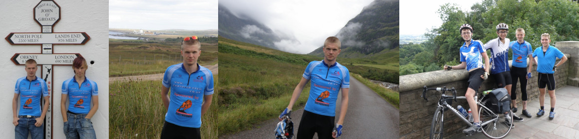
Here are my favourite cycling photos from the month


 Here for the first time ever is every single GPS cycle track on a single UK map. The data is from 13th September 2008 (when I got the Garmin Edge 705 GPS), till 15th September 2012. In that time I have logged 16,498.95 miles.
The map to the right includes the End to End cycle, that I did in August 2009. Also the places I have cycling to from Killearn and Little Bytham.
I made the map using Memory-Map.
I have done 256.3 miles so far this month. Got another 288 to do, to bet September 2011 total. If I had a whole month to do that number of miles in. It would be easy. But since I go on holiday on the 23rd, only got up till then to do it! So the weather better play nice!!
I will now leave you with the route map, elevation graph, route statistics and photos.
Route map:-

Elevation graph:–

Route statistics:-
Data from: Garmin Connect.
Photos from the cycle:-


I am pleased with myself. So far I have done, just over 200 miles of cycling this month. Yes I know that really that much, still not bad since I have only done 6 cycles so far in September. Can’t see this month being the best month for the number of miles I get to do. Since I am going on holiday on the 23rd and not back till the 30th. So all the cycling needs to be done by then.
I will now leave you with the route map, elevation graph and route statistics.
Route map:-

Elevation graph:–

Route statistics:-
Data from: Garmin Connect.
Just posted an updated map of all the places, I have cycled to from Little Bytham. The dark blue lines are the extra routes, I have added since last updating this map on 14/06/2012.

More cycling maps can be found at www.gordon-valentine.com/zenphoto/cycling/, which also include the End to End cycle maps.