February 2012 cycling statistics

Here are my cycling statistics for February. Did not do, as many miles has I was hoping due to snow. But still I have done the most miles I have ever done in any February and set a new record for the longest cycle in February.

So far my yearly stands at 708.4 miles. Total miles since April 2003 is now at 22,314.5.

Here is the data from February 2012:-

  • Total cycles: 11.
  • Total Distance: 307.39 miles.
  • Total Time: 24:40:32 (h:m:s).
  • Avg Speed: 12.5 mph.
  • Max Time: 3:27:16 (h:m:s).
  • Max Speed: 31.5 mph.
  • Avg Distance: 27.94 miles.
  • Max Distance: 44.28 miles.

Data from: Garmin Connect.

Here are my favourite cycling photos from the month

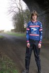
Winter cycling gearOut cyclingOut cyclingOut cycling

Four county cycle

I ended up covering four counties while doing this cycle. I think the title short of gives that away! I covered Lincolnshire, Cambridgeshire, Northamptonshire and Rutland. So not bad at all, for just a 41.77 mile cycle.

I will now leave you with the route map, elevation graph, route statistics and photos.

Route map:-

Elevation graph:-

Route statistics:-

  • Distance: 41.77 miles.
  • Time: 3:10:57 (h:m:s).
  • Avg Speed: 13 mph.
  • Max Speed: 26.3 mph.
  • Elevation Gain: 320 meters.

Data from: Garmin Connect.

Photos from the cycle:-

Out cyclingOut cyclingOut cycling

Photo search function fixed!

I am pleased to say, after using the support forum on the zenphoto website, that’s the photo search function just been fixed!

Also fixed the ‘Image Info’ link bug that “BlondGuppy” told me about. Have a feeling, I killed that when trying to fix others things. It’s all working now. So that’s the main thing of course!

Knowing bug in the photo search system

I am sure by now, some of you will have found this bug. When using the photo gallery section on this website, if you use the search option. Do a search for let’s say “cycling gear” it will show all the related photos. If you click on one, it will also display page title and nothing else :(.

I have been in contact with zenphoto they are working on a bug fix as we speak!

I will let you know once it’s been fixed!

Longest cycle and warmish day of the year

Since it was forecast to be the warmish day of the year so far. I had to make the most of it, by doing the longest cycle of the year! I have a feeling the weather forecast was correct, my phone was showing it was 16C. Which is very good for the UK, late February time.

I will now leave you with the route map, elevation graph and route statistics.

Route map:-

Elevation graph:-

Route statistics:-

  • Distance: 44.28 miles.
  • Time: 3:27:16 (h:m:s).
  • Avg Speed: 12.8 mph.
  • Max Speed: 29.7 mph.
  • Elevation Gain: 395 meters.

Data from: Garmin Connect.

Photos from today’s cycle.

Out cyclingOut cyclingOut cyclingOut cycling

Only my fourth cycle of the month

I had fun out on my bike today, doing what is only my fourth cycle of the month. By now should have at least done maybe 8 to 10 of them.  At least I am fast catching up with the miles, I want to have done by the end of the month. Including today’s ride, I have now done 105.7 miles this month. So only need to do another 113.5 to make my goal of 220 miles. Which is the number of miles I did in February last year.

I have heard people saying that snow is coming back to areas of the UK this weekend, just hope they are wrong!! Can’t be doing with snow getting in the way of me wanting to get out cycling again.

I will now leave you with the route map, elevation graph and route statistics.

Route map:-

Elevation graph:-

Route statistics:-

  • Distance: 23.06 miles.
  • Time: 2:01:15 (h:m:s).
  • Avg Speed: 11.4 mph.
  • Max Speed: 28.4 mph.
  • Elevation Gain: 295 meters.

Data from: Garmin Connect.

First 40+ mile cycle of the year

Well pleased with myself, just done my first 40+ mile cycle of the year :). But I am still way behind on miles this month. Due to all the snow and ice only been out twice. So have just 14 days, to another 180 miles. If the weather stays nice, should be easy to get that done!

I will now leave you with the route map, elevation graph and route statistics.

Route map:-

Elevation graph:-

Route statistics:-

  • Distance: 40.22 miles.
  • Time: 3:13:21 (h:m:s).
  • Avg Speed: 12.5 mph.
  • Max Speed: 29.3 mph.
  • Elevation Gain: 296 meters.

Data from: Garmin Connect.

Bored of all the cycling photos?

I am sure by now, you are bored of cycling gear photos. So here are some of me wearing leather instead :).

RST Pro Series 1 Piece Leather Suit

Oh and please comment and rate these photos!! It makes me feel all warm and happy inside when you do!